
OSINT Exercise File #1
Introduction
This is a starter project to practice my OSINT skills by demonstrating my abilities to analyze information about unknown locations. I used OSINT Exercise #4 by Sofia Santos from Gralhix.com, an OSINT site, for this project. In her exercise, she asked three questions about this image to answer: What is the name of the resort? What are the coordinates of the island? In which cardinal direction was the camera facing when the photo was taken?
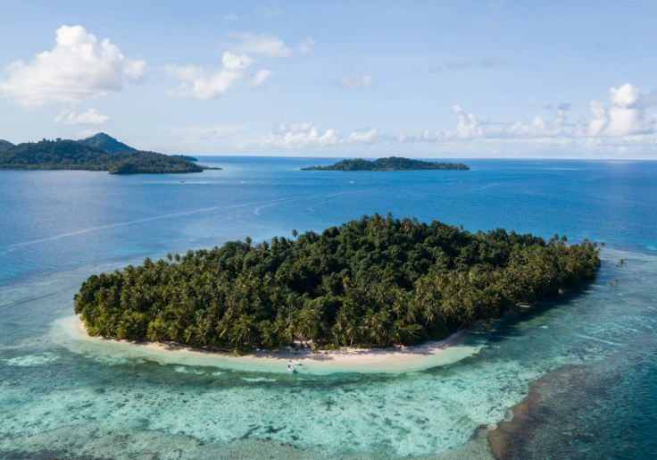
Image: Photo taken from Gralhix.com, not taken by the original author of the post on the website
Process
Before starting this, I planned out several different factors to how I would go about answering the questions provided for this exercise. Instead of just doing a reverse image search, I wanted to use the clues provided in this photo to try and narrow down my location before using other easier sources, so that I can practice utilizing different skills that are useful for geolocation.
My first major clue for this was given in the exercise, where the author revealed immediately that the location is from a tropical resort. My assumption about this resort is that these islands are either located in the Caribbean Sea or the Pacific Ocean, due to the islands in these regions being known for having tropical resorts, along with the vegetation on the islands resembling what is to be expected with these islands. The next clue is from the color of the body of water around the closest island in the image. The water color closer to the island looks turquoise, while the rest of the water is much bluer compared to other bodies of water, which appears to match up with the description of water in the Caribbean Sea. The third clue comes from what appears to be two, small, white boats that are anchored off the closest Island. Using my last clue as a guide, I looked up “Caribbean fishing boats” and found Calypso Boats, a boating company that specialized in boats for the Caribbean Sea. While the boats in the image may not be a one-to-one match of the Calypso Boats, their design is similar and the specialization can be assumed that these types of boats are found around the Caribbean. From these clues, I decided to investigate the Caribbean for this location.
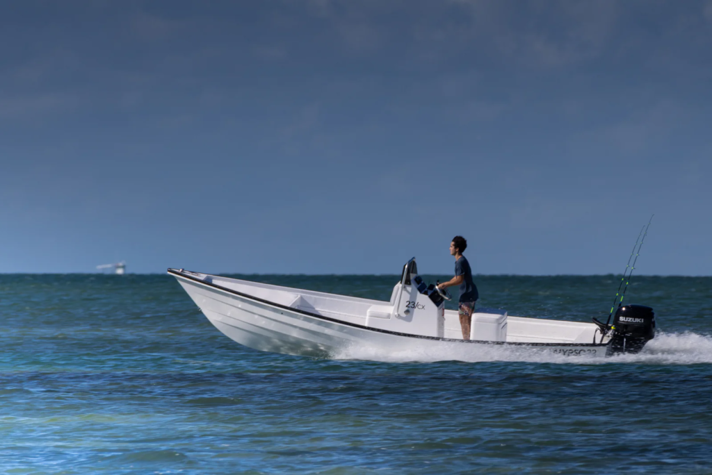
Reference Image comparing the boats, Image belongs to Calypso Boats
My initial assumptions were shown to be incorrect. After thinking that I narrowed down my search area, I used Google Maps to look around the Caribbean Sea to try and find resorts with islands that could be a match for the image. However I couldn’t find a place that matched the islands and also was home to a tropical resort. After failing to find the islands in the Caribbean, I focused my search on the Pacific instead. I first went back to check the water in the image again and to note my incorrect assumption, however, some islands in the Pacific ocean can have turquoise water, such as Bora Bora in French Polynesia and Aitutaki in the Cook Islands. With this, I now was more confident that the island was located somewhere around the Pacific.
One clue that I took a closer look at was the islands themselves. Initially, I focused more on the landscape and noticeable items in the image, such as the boats to identify the area the islands were in, to help narrow my search. However, I instead went back to focus on what was missing from the islands and to compare them to the Caribbean islands. When searching around the Caribbean, I found that a lot of the islands there had signs of development at most points, such as roads and buildings close to the shores of the islands. The islands in the image lacked any development shown, but are still home to a resort. This meant that the resort was smaller and less well known compared to other resort islands in the Pacific.
Additionally, the two islands in the back are elevated, meaning that they could’ve been formed through volcanic activity or tectonic plate movement. I decided to focus my search around the islands “near” Guam, as I found that the islands around that part of the Pacific showed a lack of development and were generally close to volcanic activity.
Eventually, after searching each island individually around the North Pacific through Google Maps, I was able to find the islands that matched up with the ones in the image. For finding the coordinates and the direction, I just used Google Maps to find my answers for questions 2 and 3 by right clicking the mouse to see the exact coordinates, and using Google Maps to state the direction that the camera was facing in the image. I also wanted to check the boats again, and found an image through the resort’s Facebook page that shows the exact boats in the original image.
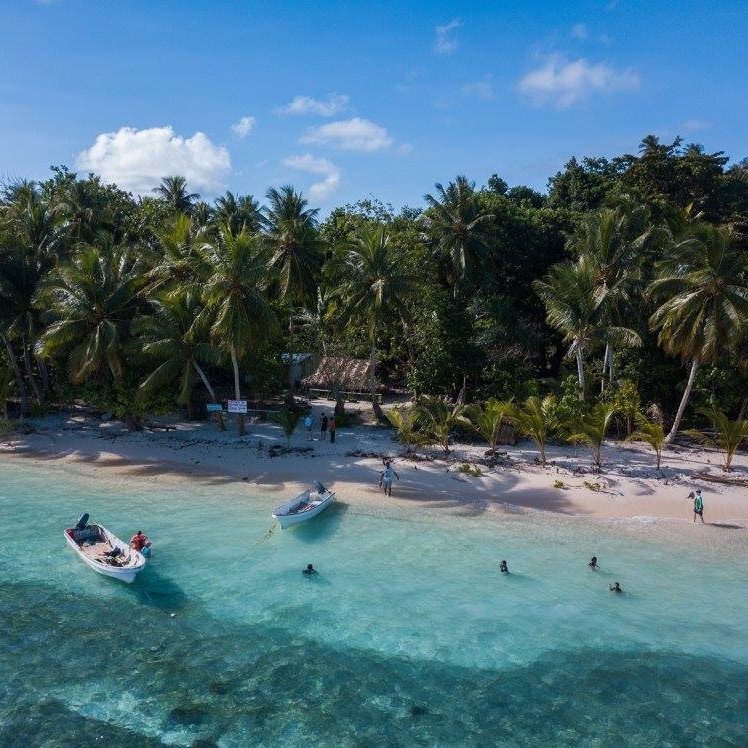
The boats in the original image, Image belongs to Oan Resort
My Answers
- Oan Resort
- 7.36273, 151.75623
- The camera is facing west
Actual Answers
- Oan Resort
- 7.36273, 151.75623
- The camera is facing west
Conclusion and Take Aways
After completing this project, I wanted to write down my thoughts and conclusions to this. It’s important to write down my main take-aways, what I accomplished, what I failed to achieve, and how I think I could do better in the future, to learn and better demonstrate my skills and abilities. And by detailing my initial process to this project, I wanted to note all of my mistakes to show how I can learn from this, because this is one of my goals for these projects, (even if the mistakes show a lack of skill necessary for the roles I want to pursue).
My main take away is that making assumptions without utilizing every single piece of information in front of you won’t get you the right conclusion. I know now that even the slightest detail in an image can be enough of a puzzle piece to get you the answer, but you need to think carefully about everything and use the information that you know to help. This was used for my search around the Pacific for the Oan Resort when I used what I had learned from the search in the Caribbean to help narrow down the general location in the Pacific by comparing the development of the islands between the two locations.
One other take away was how I failed to notice my initial bias for assuming that the islands were located in the Caribbean instead of the Pacific. When using the first clue, the water color, my thoughts leaned more towards the island being located in the Caribbean. I used that biased assumption to try and find boats that looked like the ones in the image and were found in the Caribbean, with my search being “Caribbean fishing boats”. By not recognizing my biased assumption right away, I wasted time looking in a completely different location, even as I noted that the boats I found through online search weren’t identical to the ones in the image. I’ll need to note biases such as this in the future for any other related project.
This project took just over 6 hours to complete, which is well over what is a necessary time for a professional to take, especially if this involves the lives and safety of people. I could’ve cut the time down significantly more, especially since the answer guide video provided on the Gralhix website showed reverse image searching, but I wanted to hold off on trying to do that so I could build other OSINT skills. There were a lot of mistakes that were made with this first project, but it should be a good learning experience on how to deal with other projects going forward.
The answer guide provided in the Gralhix website: https://gralhix.com/list-of-osint-exercises/osint-exercise-004/